|
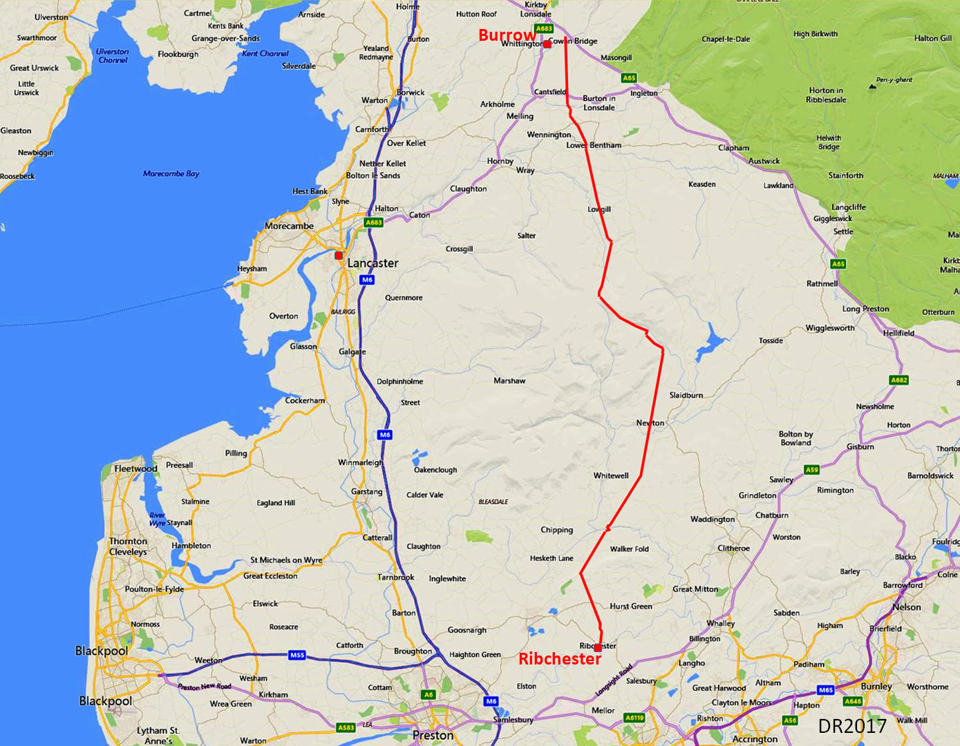
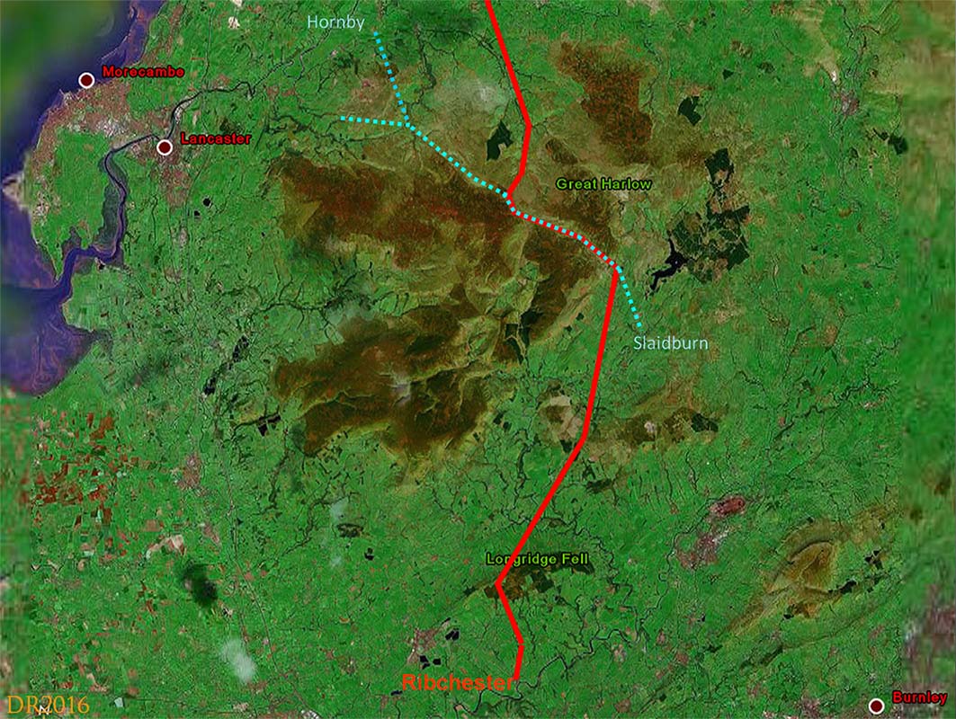
The Roman Road from Ribchester to Burrow in LonsdaleMargary Number: 7cDistance: 28.75 miles (+1 mile extra on link road to Burrow Fort = 29.75 miles)Continuation northwards of probably the original Roman military route from Manchester. The distance of just under 30 miles is exceptional for a days march especially given the severity of the terrain encountered reaching a height of 1400 feet on the Croasdale Crossing. You would have expected an intermediate fort or fortlet but so far I have not found one! |
Historic County: Lancashire & West Riding of Yorkshire Current Counties: Lancashire & North Yorkshire HER: Lancashire & North Yorkshire
|
|
|
|
|
|
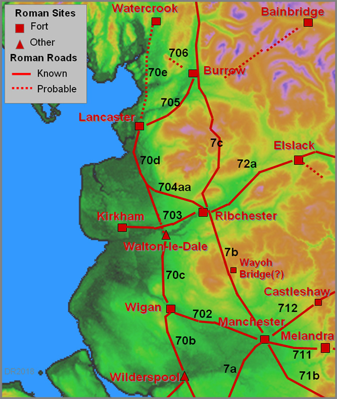
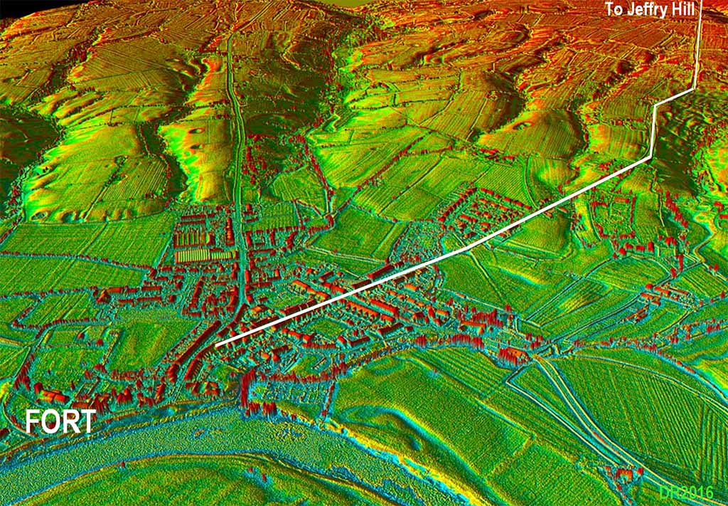
Ribchester Roman Road Map The original fort was further north than the later stone fort and the road layout was clearly designed/set out for the first fort. Our road, Margary 7c, heads out along Water Street and continues via Ribblesdale Road which in turn becomes the appropriately named Stoneygate Lane. |
Click for larger view
|
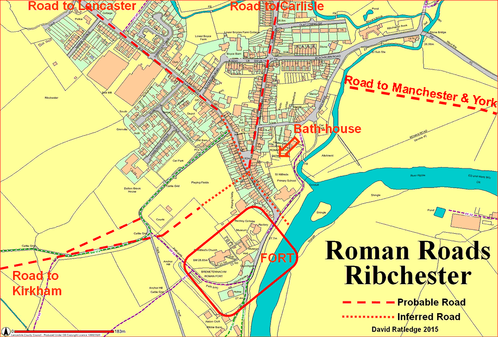 |
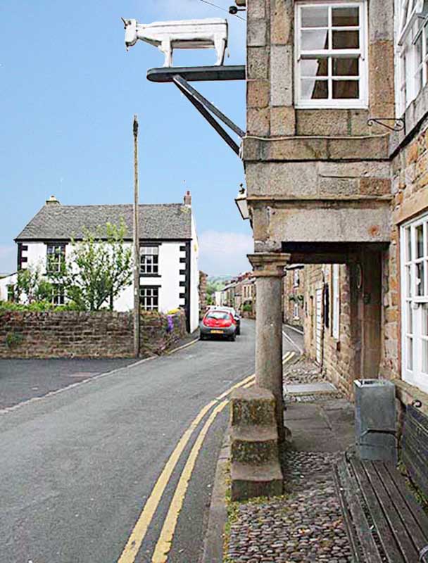
Water Street, Ribchester The original fort's east gate is behind us here and our road heads up Water Street passing the White Bull and its probable Roman columns. There are actually 4 columns - two either side of the entrance. The Bath House is to the rear of the pub so this site would have been an excellent one for a pub in Roman times too! |
Click for larger view |
 |
3D Oblique Lidar Image - Regaining the Alignment The direction of the road from Ribchester is not on Jeffrey Hill but angles to regain the setting-out alignment from Top of Ramsgreave to Jeffrey Hill. This is normal Roman practice. At Cherry Yate, originally Chester Gate, the road angles parallel to the above alignment but has to dogleg again a short distance further north to regain the actual alignment. Note: modern OS maps incorrectly show the road from Longridge passing into the field behind Cherry Yate directly onto the alignment. This is incorrect. An inspection on site and the Lidar data shows no evidence for that. The modern road marks its true course. The OS route would have a nonsensical drop in level and subsequent needless climb back up again. No they were smarter engineers than that. |
Click for larger view
|
 |
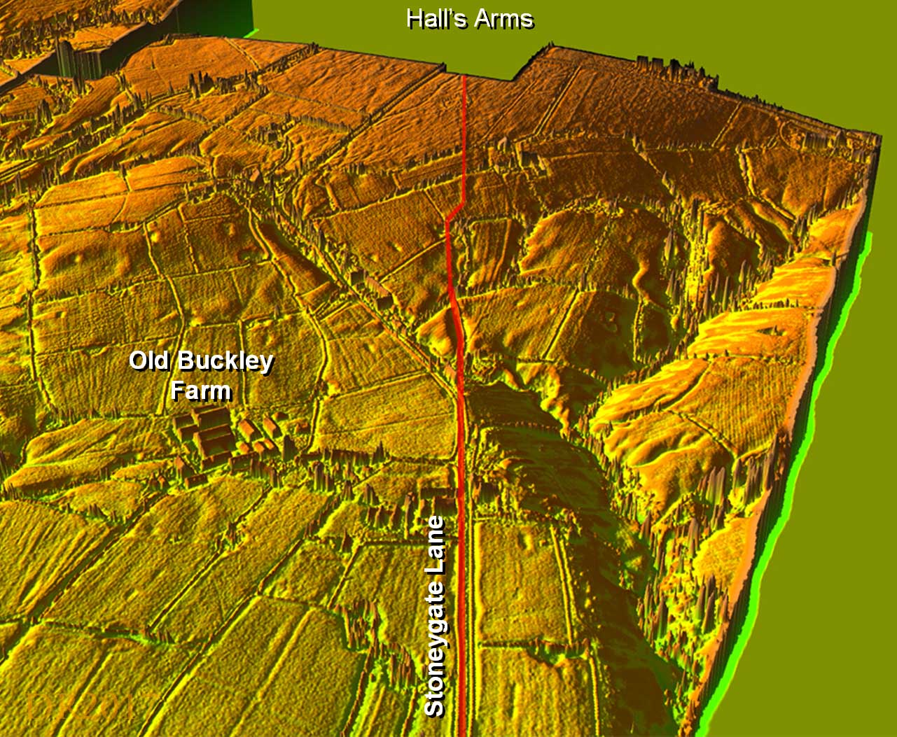
3D Oblique Lidar Image - Coxes Farm Deviation At Coxes Farm/ Rowan Garth the modern road diverges off the Roman line. Just beyond here the Roman alignment if carried on straight would have run up a small stream and into a pond. The Lidar data indicates the road probably diverted to the west slightly for drier ground. There is no Lidar data (currently) available for the Hall Arms area but the Roman agger is clearly visible in the field south of the inn.
|
Click for larger view |
 |
Jeffrey Hill - View North The panorama from Jeffrey Hill is one of the best views in Lancashire with the Bowland Fells centre stage. Even the Roman engineers baulked at going straight ahead and with a choice of North-West or North-East chose the latter. So the alignment swings 54 degrees to the NE and heads for Croasdale via Browsholme Heights.
|
Click for larger view |
 |
Aerial Map - Croasdale Route The course they chose at first seems an odd one. A route via Dunsop Bridge and Whitendale is more direct and surely within their capabilities. But no they headed towards Slaidburn and the Salt or Hornby Road which crosses the Bowland Fells via Croasdale and Salter Fell. The only explanation I can envisage is that the Salt Road was already there when they arrived and they took the pragmatic solution to make use of it and upgrade just the length they needed. The Salt or Hornby Road was possibly therefore an Iron Age pre-Roman route for salt from Morecambe Bay to East Lancashire and Yorkshire. There are several Salter names along it perhaps supporting this theory. |
Click for larger view |
 |
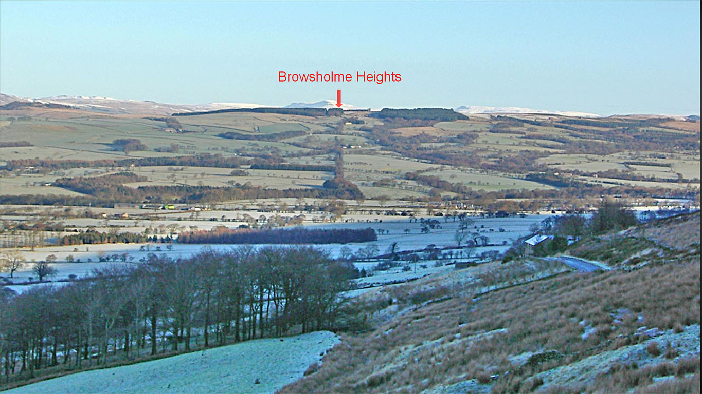
Jeffrey Hill to Browsholme heights Alignment The Roman road can be seen angling across the steep slope of Jeffrey Hill just below, and parallel to, the present road and marked by hedgerows in the distance. This section was aligned on Browsholme Heights although it is often claimed it is aligned on the the summit of Penygent, visible in the far distance on very clear days. Our photo indicates not on Penygent but it demonstrates how Roman engineers did use high points (Browsholme Heights) to set out their roads. |
Click for larger view |
 |
Lidar Image and Route Map - River Hodder Crossing 1 The major obstacle on this alignment was the (first) crossing of the Hodder - this was the old Lancashire-Yorkshire boundary until 1974. Following the construction of a pipeline, the zigzag ascent north of the river was spotted by Peter Iles. Taken with the zig-zag on the southern descent this demonstrates very clever engineering to get down to what must have been the best crossing point. Note the Ordnance Survey line just carries straight on across the river and, as we now now know, incorrectly. Further on a minor road continues the line but at Cow Ark and Marl Hill it deviates off leaving a trace visible on aerial-photos. |
Click for larger view |
 |
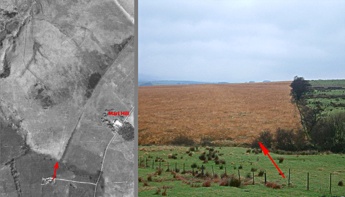
Aerial Photo (c.1947) and Ground level View - Marl Hill At Browsholme Heights the road swung more northerly aimed at Low Fell at the start of the Croasdale Valley. This change of direction near Marl Hill had been questioned by Ben Edwards - the modern road route he thought more logical. But an LCC scanned 1947 aerial photo appears to confirm that it did indeed change direction here just as the OS First Edition surveyors recorded. The ground level view by Peter Iles confirms this too with the large agger showing as slightly lighter coloured grass. The two red arrows are roughly in the same spot. . |
Click for larger view |
 |
3D Oblique Lidar Image - River Hodder Crossing 2 The alignment change at Browsholme Heights is also supported by Lidar, which shows the Roman road heading for second crossing of the Hodder at an ideal fording or bridging point - just where there is a natural limestone outcrop. |
Click for larger view |
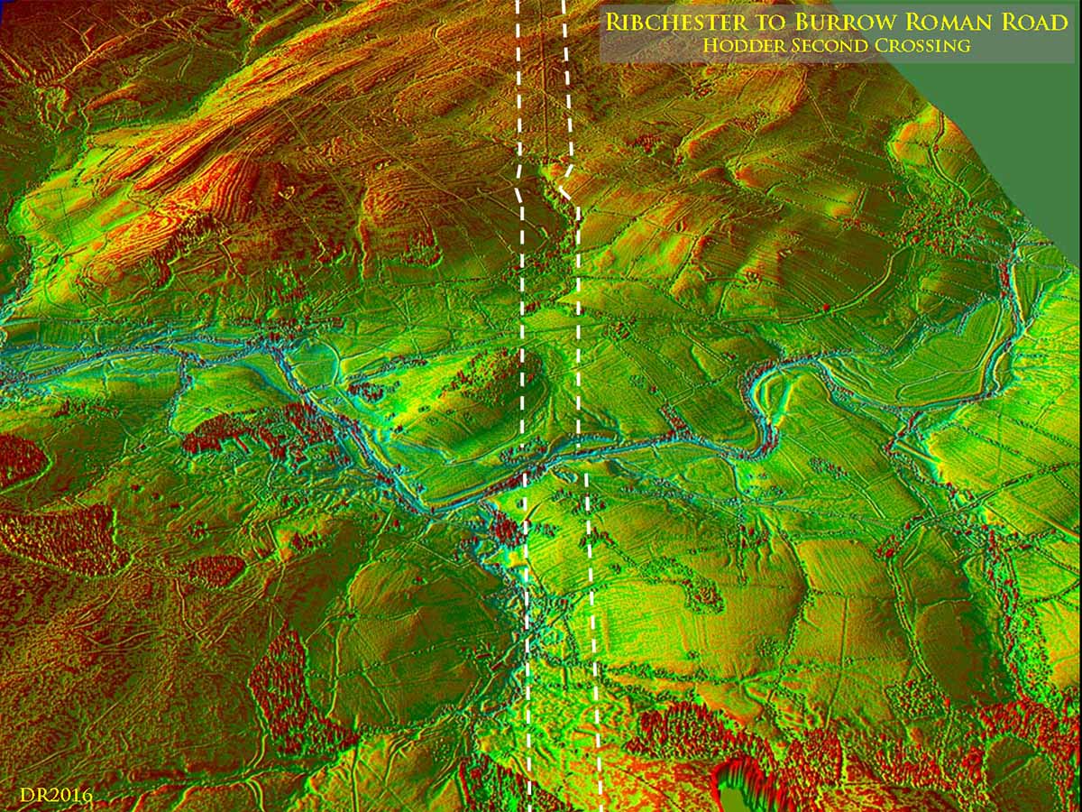 |
Lidar Image & c.1947 Aerial Photo - River Hodder Crossing 2 This second crossing of the Hodder would have been a very logical position for an intermediate fort. The c.1947 aerial photographs actually appeared to show just that! However, site visits and Lidar data shows it was a false supposition. The image (right) is an animated gif and alternates between the Lidar image and that 1947 aerial photo. |
Click for larger view |
 |
Start of the climb up the Croasdale Valley The start of the route the Roman engineers chose through the Bowland Fells was via Croasdale. Part of the track is now known as the Hornby Road (or Broken Bank Head). The most logical explanation of the route selected as we have seen is that it probably made use of a pre-Roman salt route across the fells - the Romans simply adopted and upgraded it. It must have been a daunting journey in bad weather. The ascent to the pass was adapted to the contours. Alongside the road are several borrow pits - i.e. quarry pits where the Roman quarried for road stone. No point carrying materials miles when it was available next the road. For more details and many images of the spectacular Croasdale section of the Road - click here. It is a walk every Roman road enthusiast should undertake at least once! Video - Crossing the Croasdale Fells in winter. The wind is whistling and there's an inch of snow on the ground! |
Click for larger view
|
 |
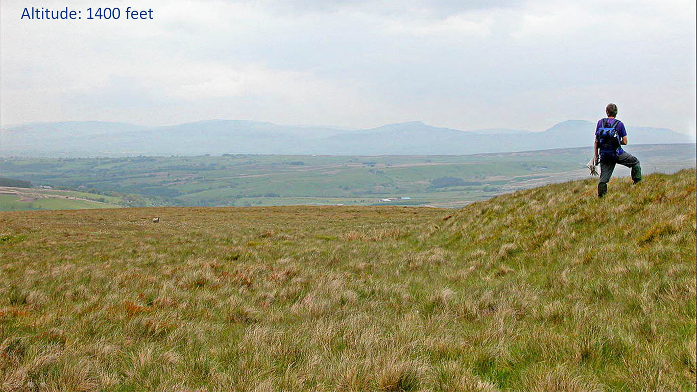
Near the 1400 feet Summit - Roman Road Cutting Here we are near the summit, just at the start of the descent to the Hindburn Valley. The Roman engineers, despite being 1400 feet, up have cut into the hillside to produce a level platform for the road. The person on the right is standing on the side slope of that cutting and the road is to his left. The image is taken stood on the road. . |
Click for larger view |
 |
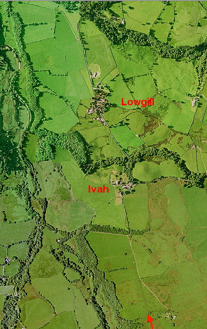
Aerial Photo - Hindburn Valley The road ran down the east side of the beautiful Hindburn valley heading through Ivah and Lowgill . |
Click for larger view |
 |
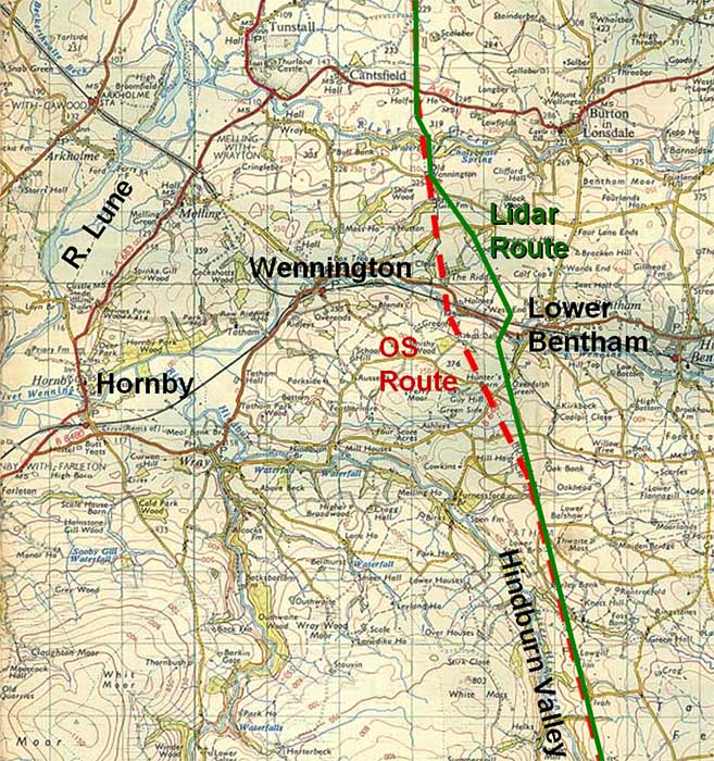
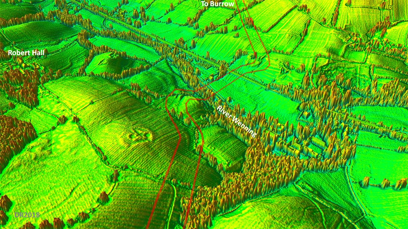
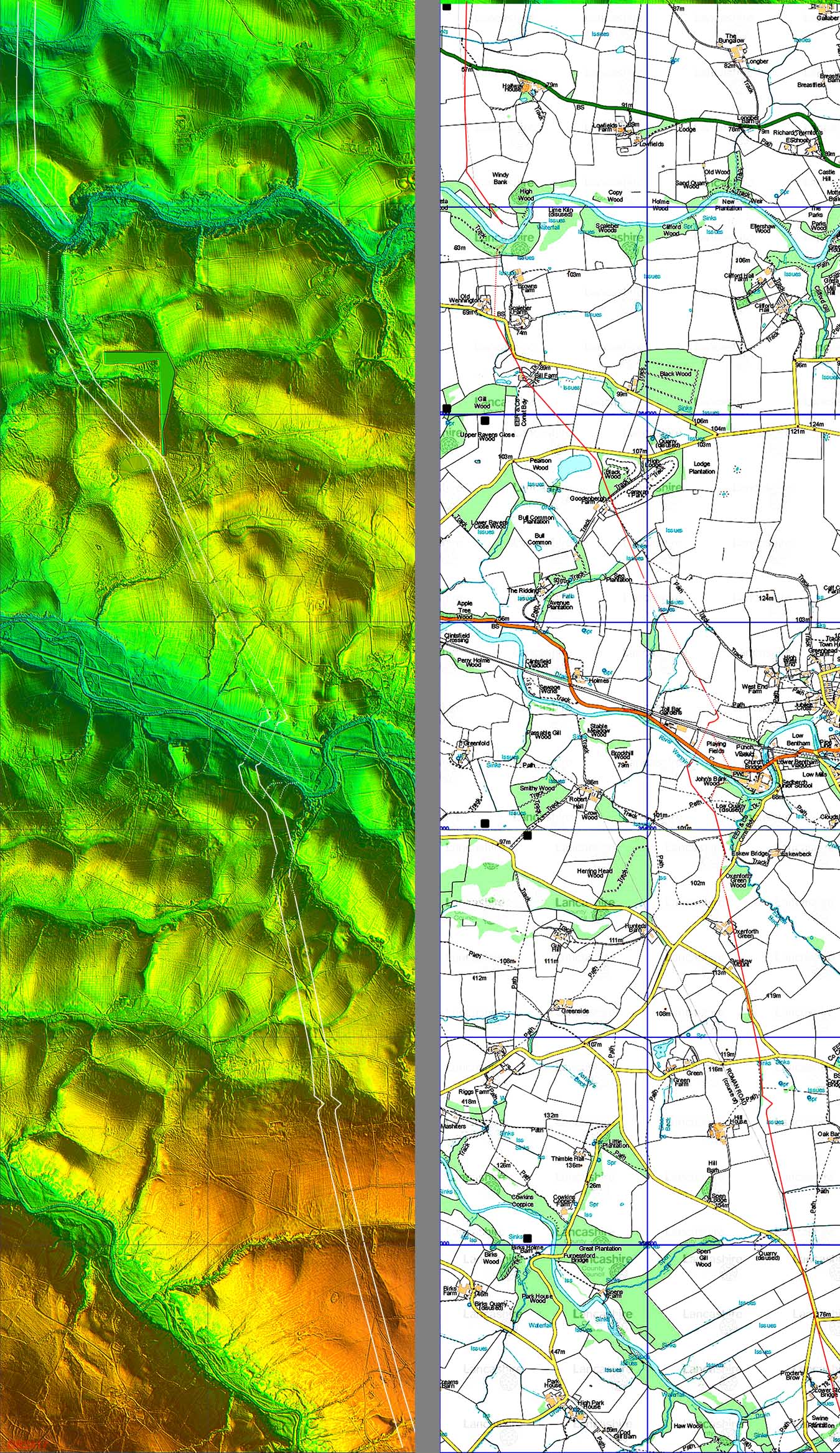
Route Map - OS and Corrected Route Recent Ordnance Survey maps have shown the road leaving the Hindburn valley and then taking a dogleg to the north-west under Robert Hall and following a course on or near to the county boundary between the River Wenning and River Greta. I had long been suspicious of this and it was one of the first routes I checked with Lidar. What Lidar showed is that there is nothing visible on the OS Robert Hall route but there is very clear evidence for the alignment from the Hindburn valley continuing straight on to the River Wenning. Interestingly the first edition 6" OS maps had the road carrying reasonably straight on but on a different course (further west) - right in principle but not in detail. The agger of the road from the River Wenning to the River Greta also shows up well in the Lidar data confirming this corrected route. The route of the road is shown right in green and that currently (incorrectly) plotted on Ordnance Survey maps in red. Unfortunately this discovery places the road further east and into Yorkshire! |
Click for larger view |
 |
NEW - 3D Lidar video flyover of the "new" section
|
||
Agger descending to Mewith Lane Back on the ground - it is hard to understand how the Ordnance Survey missed this. The Roman Road has to cross Mewith Lane somewhere and even from a car it is obvious where it really does cross. The trees mask the agger somewhat but it is still unmistakable. |
Click for larger view |
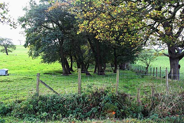 |
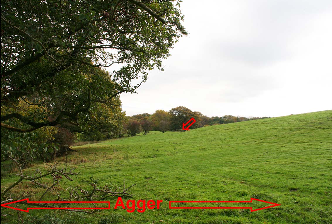
Agger below Romano-British(?) enclosure (SD 6430 6914) Between Escow Bridge and the River Wenning the Roman road skirts around a hill with what looks like a Romano-British Enclosure on top of it (see next 3D image). It is reasonably easy to locate and this picture was taken from the public footpath.
|
Click for larger view |
 |
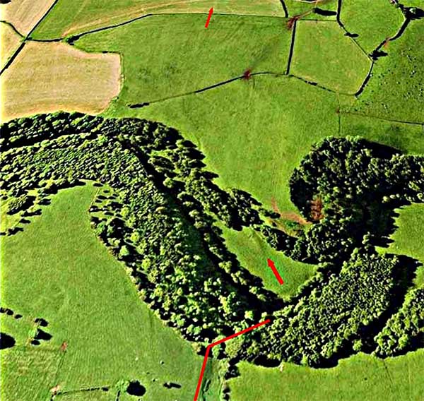
3D Oblique Lidar Image - River Wenning Crossing This was a bit of a puzzle as there appears to be two crossings. What we decided (Hugh Toller and myself) was that the one shown is the second crossing. An earlier one probably descended where the road first bends left and crossed the Wenning bottoms to the same ascent cutting. For some reason this was replaced by the route highlighted and a new descent cutting created but it still used the same ascent on the north bank. The first route shows very faintly in the Lidar data.
|
Click for larger view |
 |
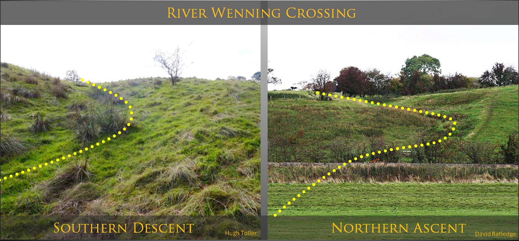
River Wenning Crossing - Descent and Ascent Cuttings Both cuttings are similar in principle - curving to ease the gradients.
|
Click for larger view |
 |
Aerial Photo of River Greta Crossing - Descent and Ascent As is typical of Roman engineering the road angles across the slope to get down to the River Greta. Having crossed the river (back in Lancashire), the road ascends Windy Bank (SD632720) in a north-westerly direction before turning back north onto the accepted line.
|
Click for larger view |
 |
Lidar Image and Route Map - "new" section Lidar has provided the correct course of the Roman road from the Hindburn Valley to north of the River Greta. The map includes the two probable routes crossing the River Wenning. The original being the eastern one, the final the western one. |
Click for larger view |
 |
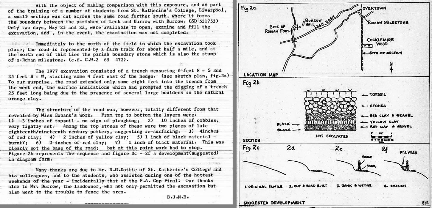
Excavation Report - Ben Edwards 1977 (SD 630 753) Ben Edwards, the former County Archaeologist for Lancashire, lead an excavation of the road south of Burrow in May 1977. The report (right) is from the Lancashire Archaeology Bulletin (LAB) 1977. It would appear that only the eastern half of the road was excavated as the remainder was on the western side of the hedge and covered by soil creep. There was no mention of a eastern ditch. Late C18/C19 pottery was found on the road surface indicating it was probably still in use then - 1400 years after the Romans had left! The excavation Ben was comparing it to was one carried out near Castleton (Cumbria) by Miss Ewbank. Thanks are due to Peter Iles for digging out this article and he also pointed out that the NGR quoted in the article is wrong. My suggested correction is SD 630 753. |
Click for larger view
|
 |
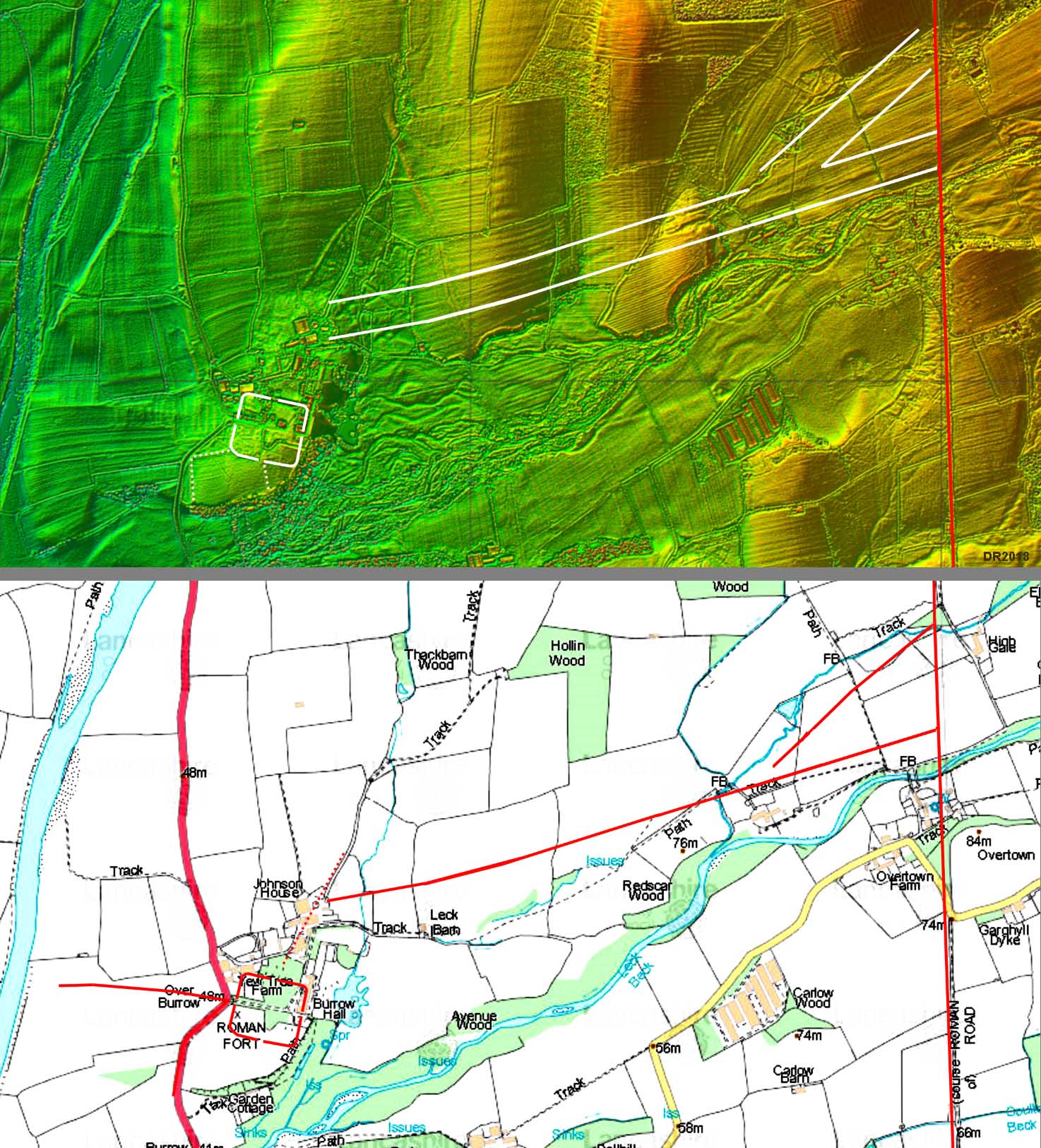
Burrow Fort - Lidar Image and Link Road Route Map Our northward bound Roman road passes around 1 mile to the east of Burrow Fort. A link road to Burrow would have been required and Lidar has revealed its course, perhaps surprisingly on the north bank of the Leck Beck. What is also clear from the Lidar image is how big the flood plain of the Leck beck is. The road keeps well clear of it. At its eastern end the link road almost certainly bifurcates with one branch for traffic to the north and one for traffic from the south. The important consequence of this road arrangement is that it implies that the road from Ribchester was here earlier than the road from Lancaster. It is the Ribchester road that unerringly carries on northward not the road from Lancaster. This would put in serious doubt the theory that the road from Lancaster was the earliest conquest road (ref. Shotter). The Ribchester road would seem to have won that battle. For details of the Burrow Fort, vicus and possible watch tower see Margary 705 |
Click for larger view |
 |
3D Oblique Lidar Image - Looking North Our road can be clearly seen continuing on almost due north over the county boundary into Cumbria. For its continuation to Low Borrowbridge - follow link |
Click for larger view |
 |
|
|
|
Last update: April 2018 |
© David Ratledge |