|
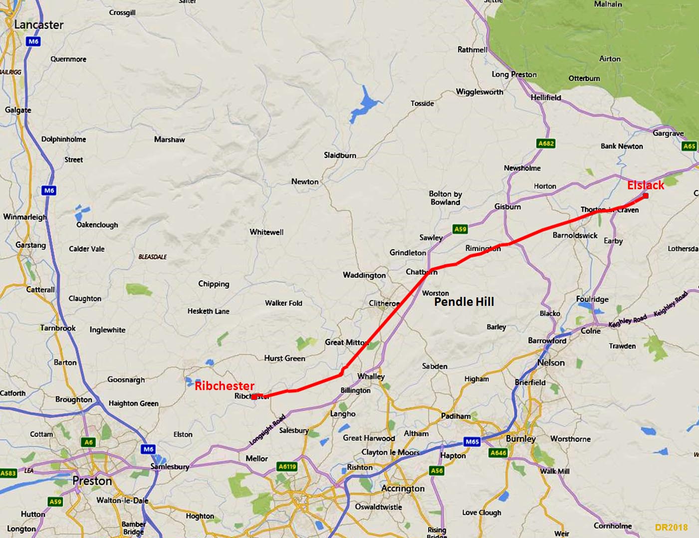
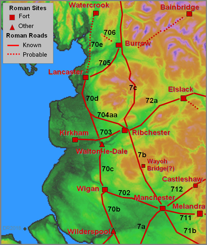
The Roman Road from Ribchester to ElslackMargary Number: 72aDistance: 20 milesThis Roman road is clearly targeted on linking Ribchester to York and it goes via the forts of Elslack and Ilkley. The direct line to the first, Elslack, is blocked by Pendle Hill so a route skirting around its northern slopes was devised. Its initial route as far as Chatburn keeps to the south side of the River Ribble. GIS analysis has shown the Romans knew the extent of the Ribble floodplain and sensibly kept well above it. |
Historic Counties: Lancashire & West Riding of Yorkshire Current Counties: Lancashire & West Yorkshire HER: Lancashire & West Yorkshire
|
|
|
|
|
|
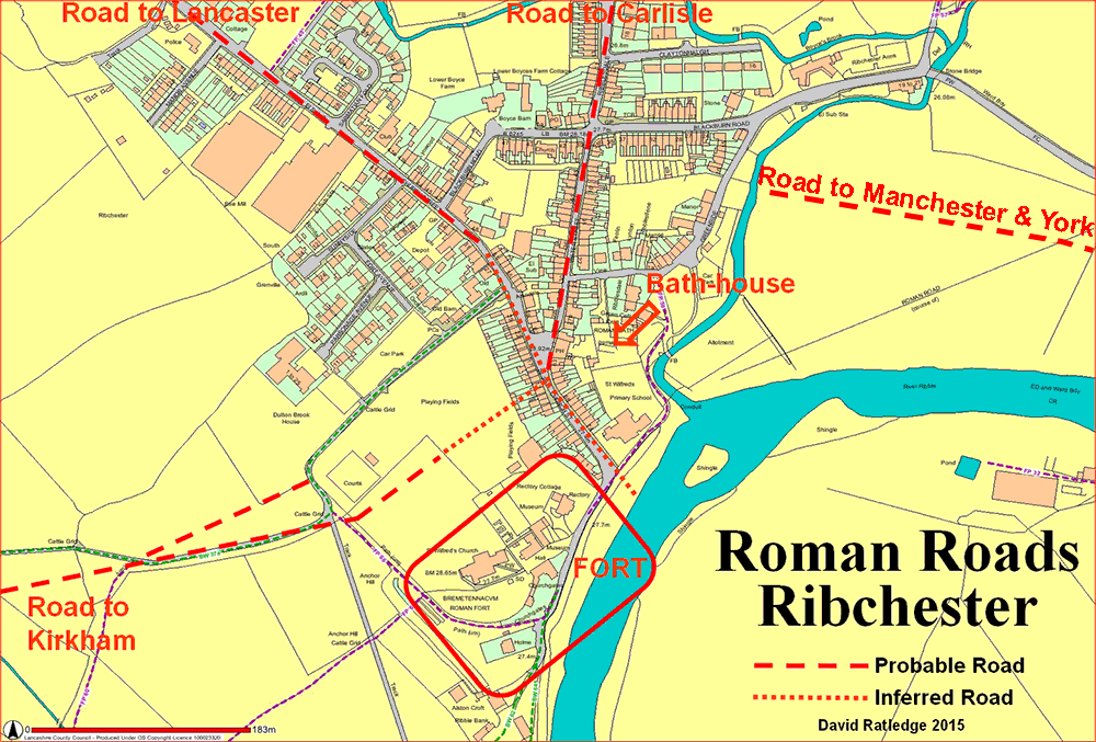
Ribchester Roman Road Map The original fort was further north than the later stone fort and the road layout was clearly designed/set-out for the first fort. Our road, Margary 72a heads out initially along Water Street before turning right beyond the Roman Bath House and heading for the site of the River Ribble Bridge. Note the OS line for the road shown on the map is incorrect. |
Click for larger view
|
 |
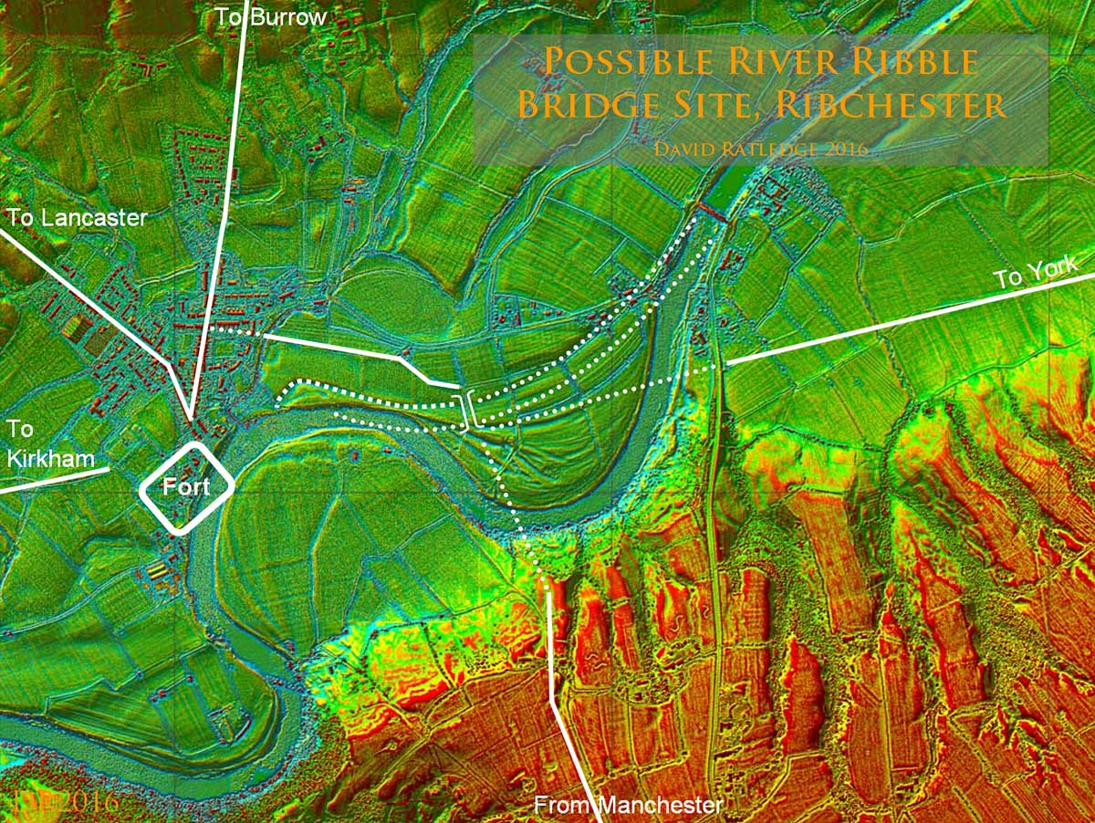
Lidar Image - Route to Probable River Ribble Bridge The site of the Roman bridge at Ribchester over the River Ribble has been the subject of much speculation but with the advent of Lidar we can now make an informed guess at to where it could well have been located. Obviously the Bridge would have been where all the roads converge. The road from Ribchester passes south of Beech House. Also visible is the route of the road down to the Ribble valley from Manchester and that of the road to Elslack (for York). Also visible are old channels of the River Ribble. See Margary 7b for more details |
Click for larger view
|
 |
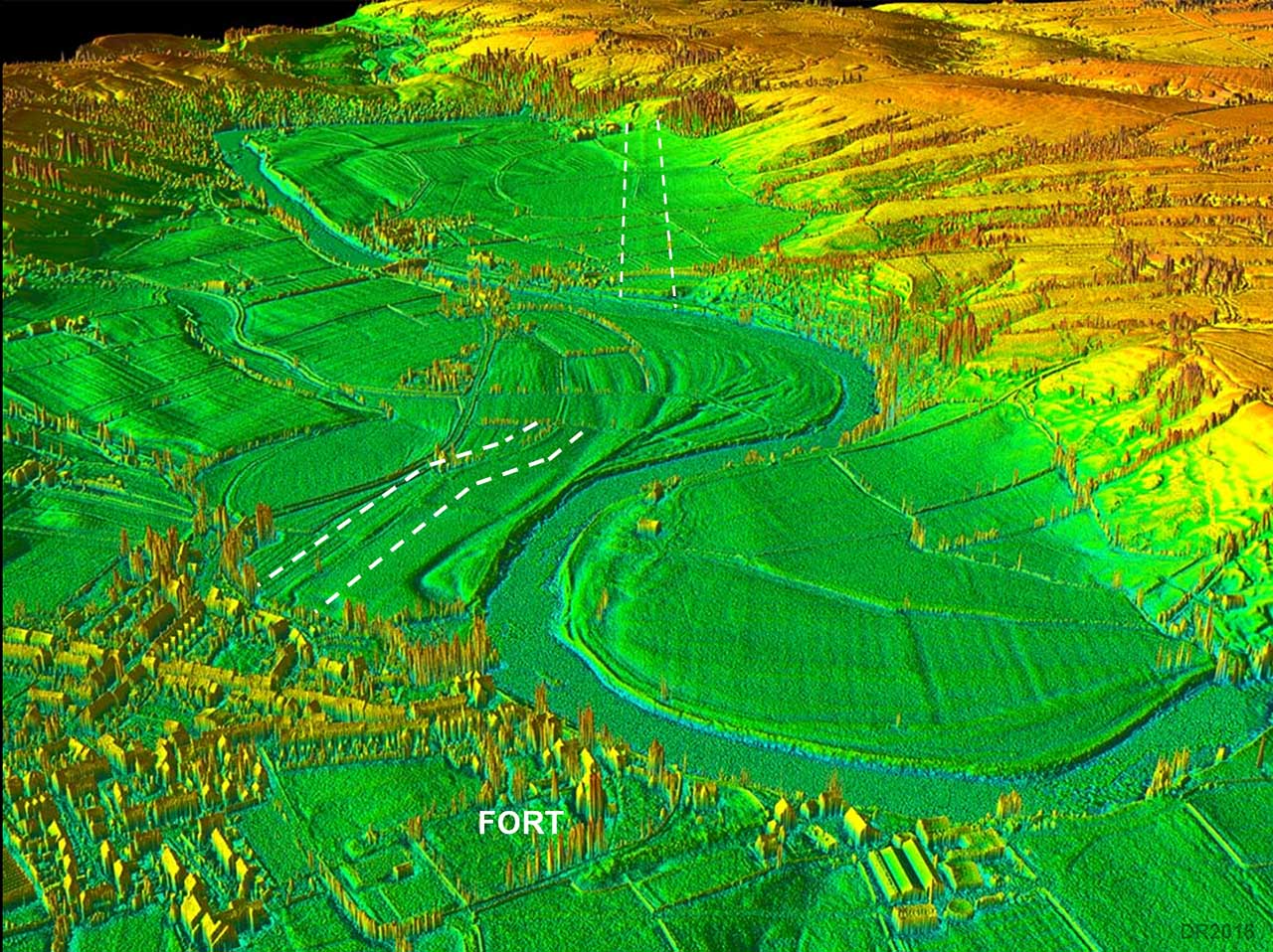
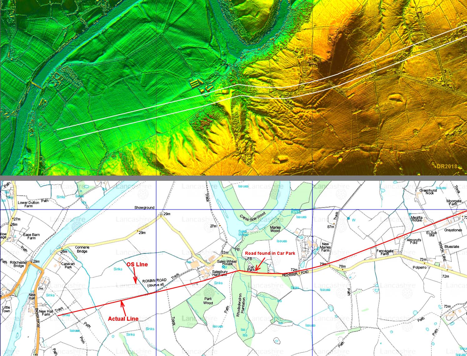
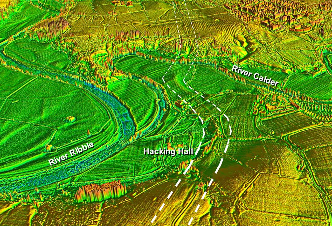
3D Oblique Lidar Image - looking East The correct course of the road lies between the dotted lines and can be made out in this Lidar view. Current Ordnance Survey maps incorrectly plot the course of this road from Ribchester but Lidar has revealed the correct route out of the valley bottom passing Salesbury Hall. |
Click for larger view |
 |
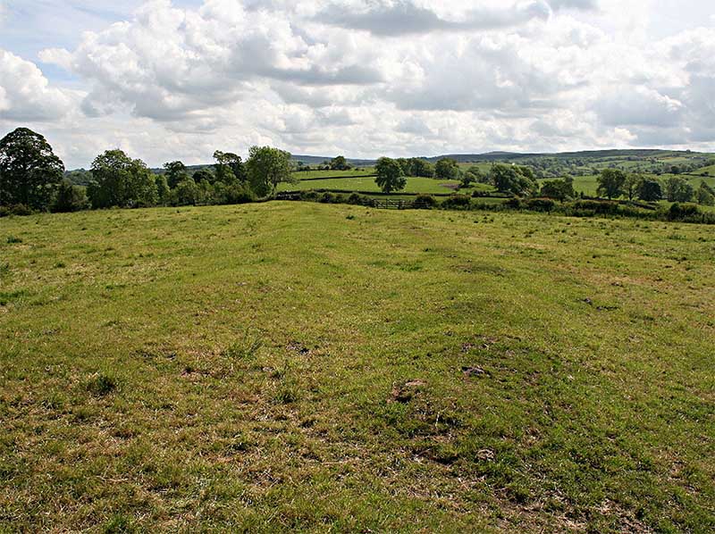
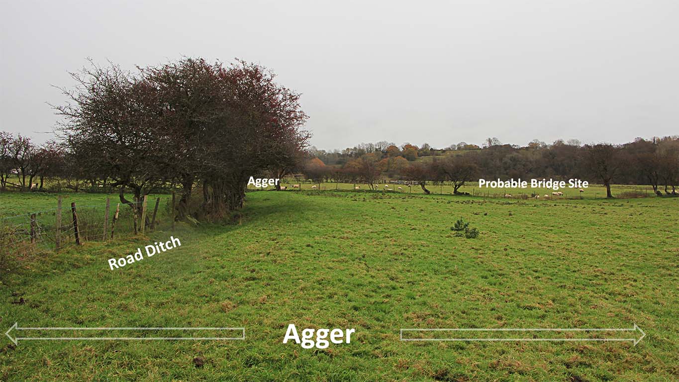
Agger passing Beech House - looking East This is on the link road from Ribchester to the probable River Ribble Bridge. The agger finishes at the fence line at the end of the field. It would have turned there and accessed the bridge via an approach ramp.
|
Click for larger view |
 |
Ordnance Survey Map - Salesbury Hall and Marles Wood The line of the Roman road revealed by Lidar matches perfectly where it was found (SD6764 3560) when Marles Wood car park was constructed. At the entrance to the car park the line of the road has been marked by posts. The road itself is not visible. The site of the Roman Bridge over the stream through Marles Wood is where the modern bridge is located. |
Click for larger view |
 |
|
NEW VIDEO - 3D Lidar fly-over along the line of this road into Ribchester from Dinckley i.e. east to west.
|
||
Lidar Image and Route Map - Salesbury West of Salesbury Hall the Roman Road is further south than that shown on OS mapping but east of Salesbury Hall then it is further north |
Click for larger view |
 |
3D Oblique Lidar Image - River Calder Crossing For the crossing of the Calder, near Whalley, the OS line is not quite correct - there is a slight dogleg to negotiate the river. I was surprised to see the large agger leading to the crossing had survived so well and it shows clearly on the Lidar imagery (right). Also visible is the cutting for the ascent up from the river bottoms on the east side of the river. |
Click for larger view |
 |
Aerial View - passing Clitheroe Golf Course Not the best quality image but worth including. The alignment heads south of Clitheroe and is well marked by field boundaries so shows up well.
|
 |
|
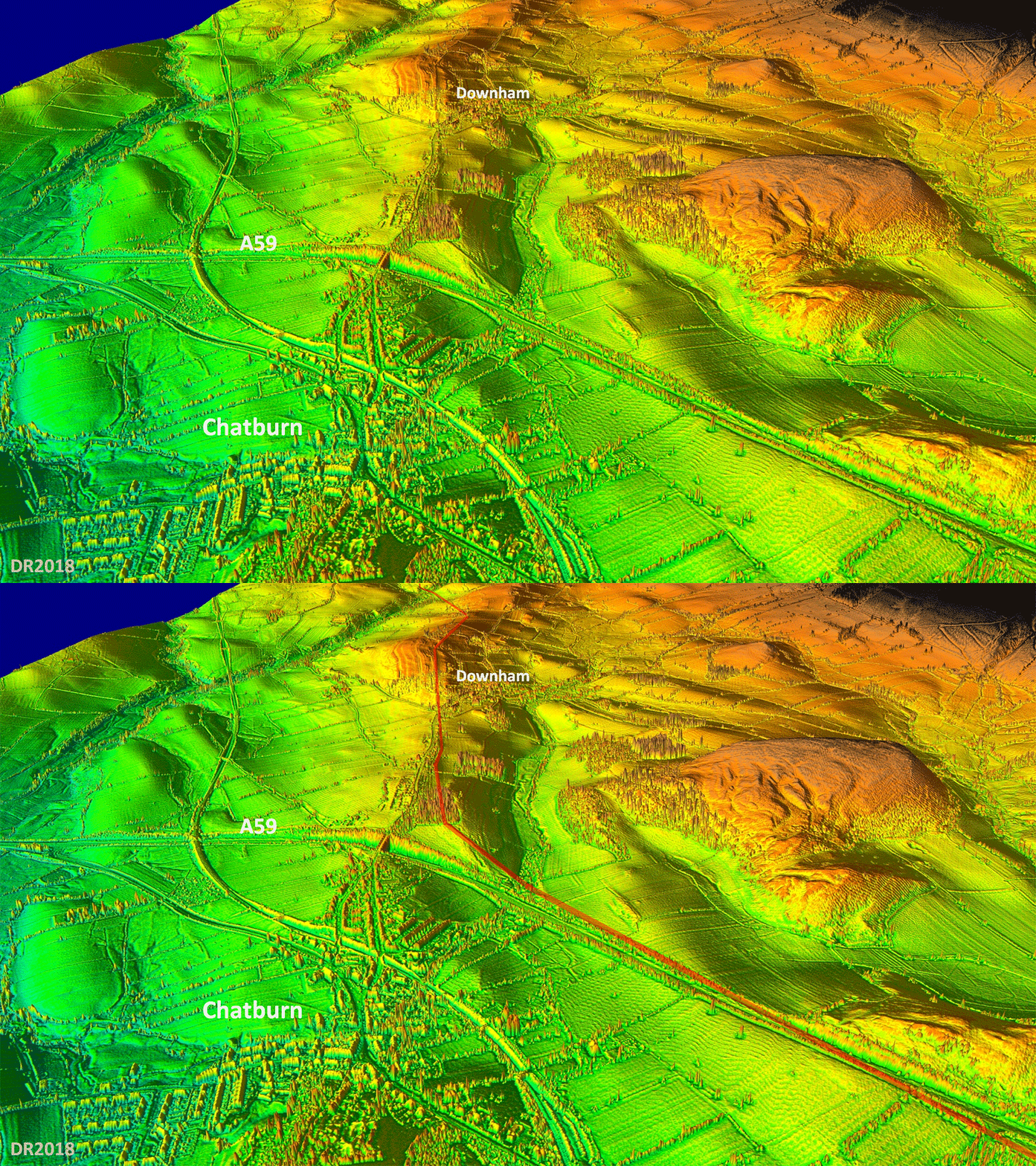
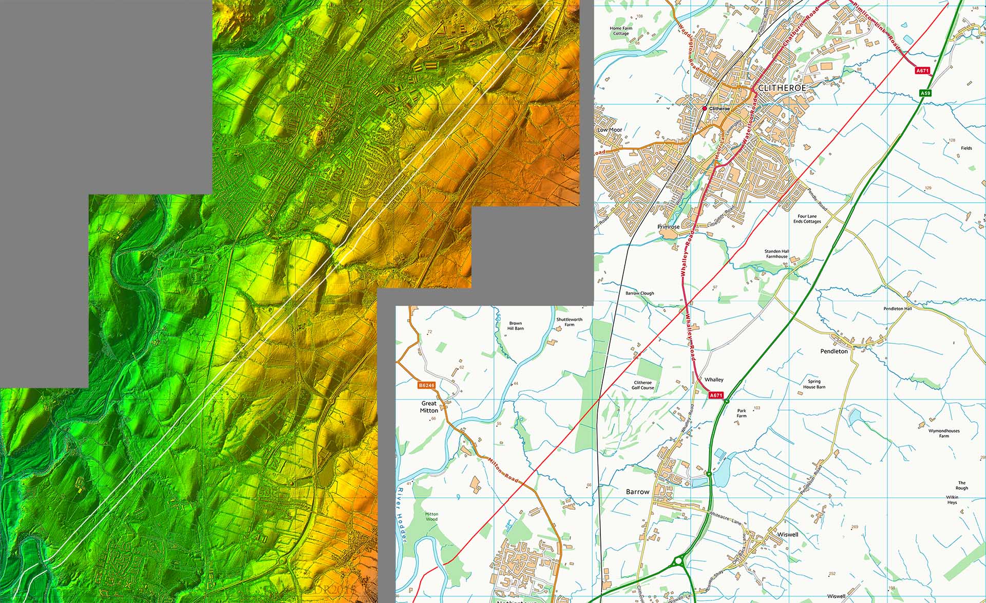
Lidar Image and Route Map - Whalley to Clitheroe Both Whalley and Clitheroe are off the line of the road. This was a major road (Kings Highway) lasting over 1000 years after the Roman left so why did these two towns avoid it? The reason of course is that these roads were often bad news. Any invaders, cattle rustlers or robbers could use the road for a smash and grab raid. Better to settle away from the road and keep out of harms way. |
 |
|
|
|
Last update: April 2018 |
© David Ratledge |
